
")


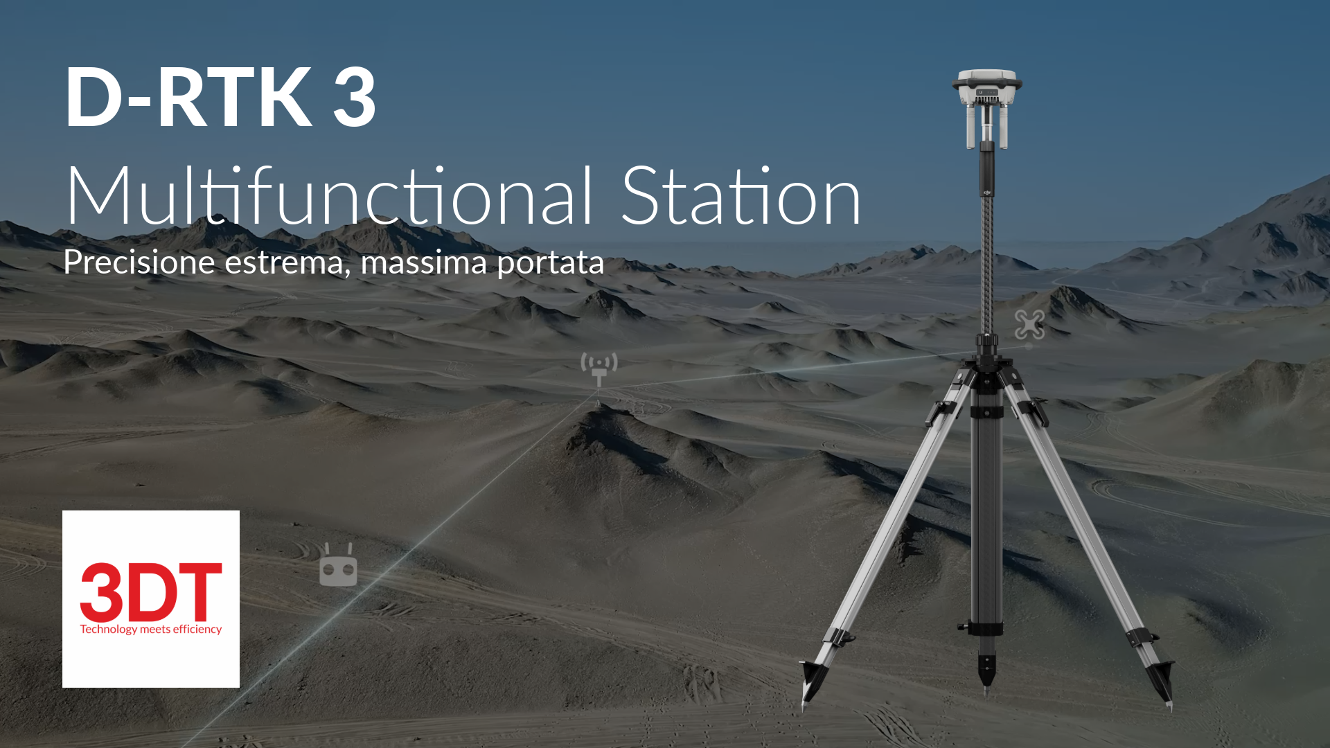
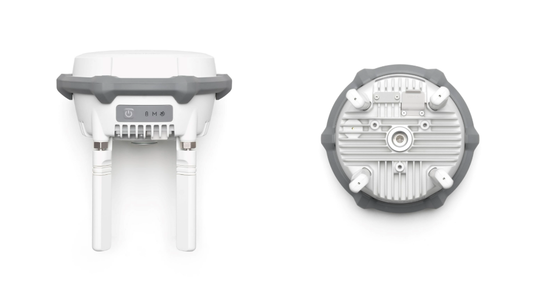
D-RTK 3 Multifunctional Station
Sku:
High-precision positioning system
D-RTK 3 Multifunctional Station, High-precision positioning and retransmission system
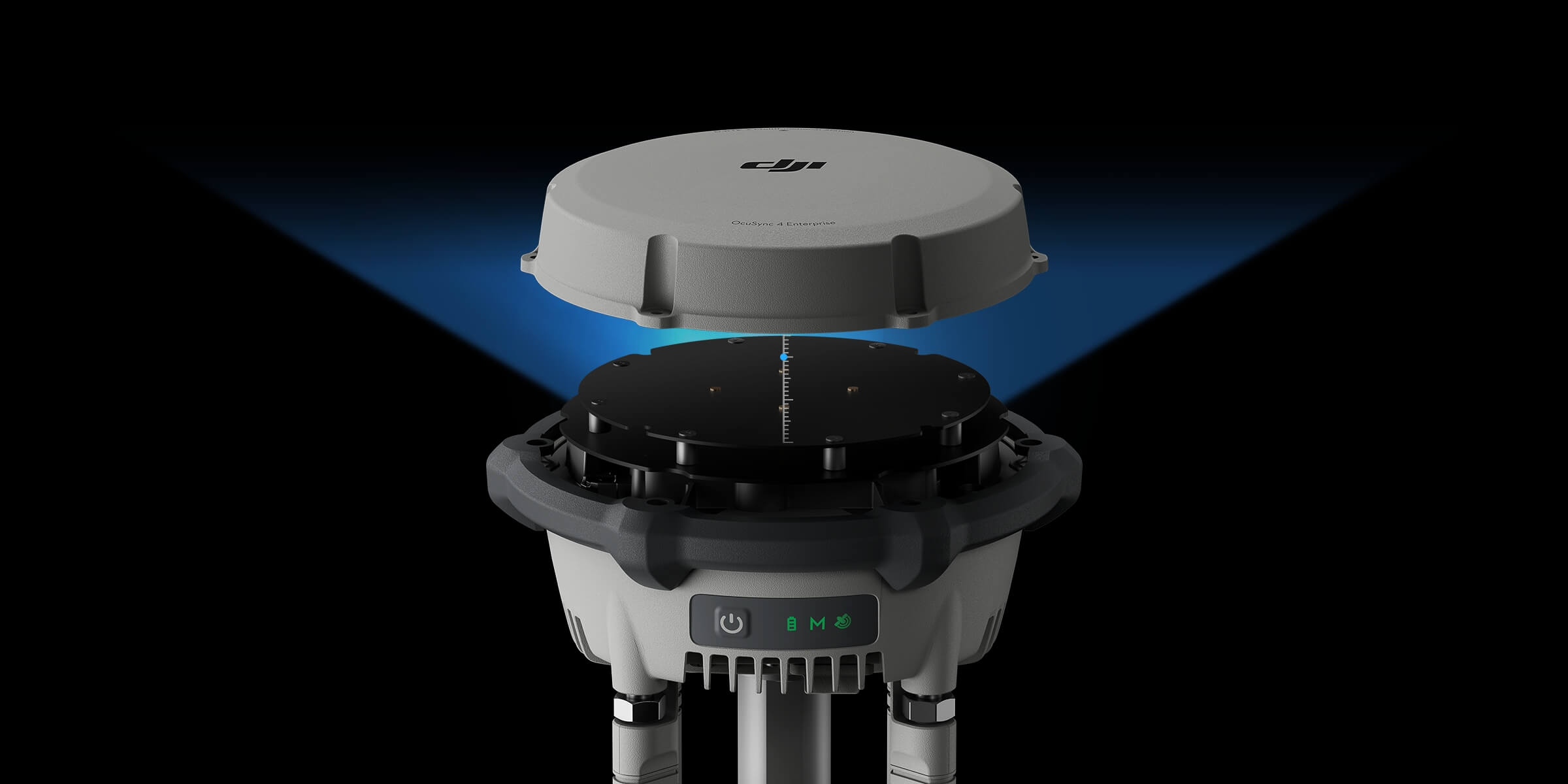
The new D-RTK 3 Multifunction Station integrates high-performance antennas and receiver modules, capable of monitoring and resolving data from leading global satellite navigation systems. It supports multiple data transmission links and can analyse the device's position and orientation via an integrated high-performance inertial measurement unit. With these outstanding features, it can act as a radar station to provide centimetre-level positioning for multiple drones simultaneously or extend the operational range of drones in relay station mode. In addition, the new Rover Station mode, combined with the DJI ENTERPRISE app and DJI Terra, offers a complete solution for high-precision aerial surveying applications.
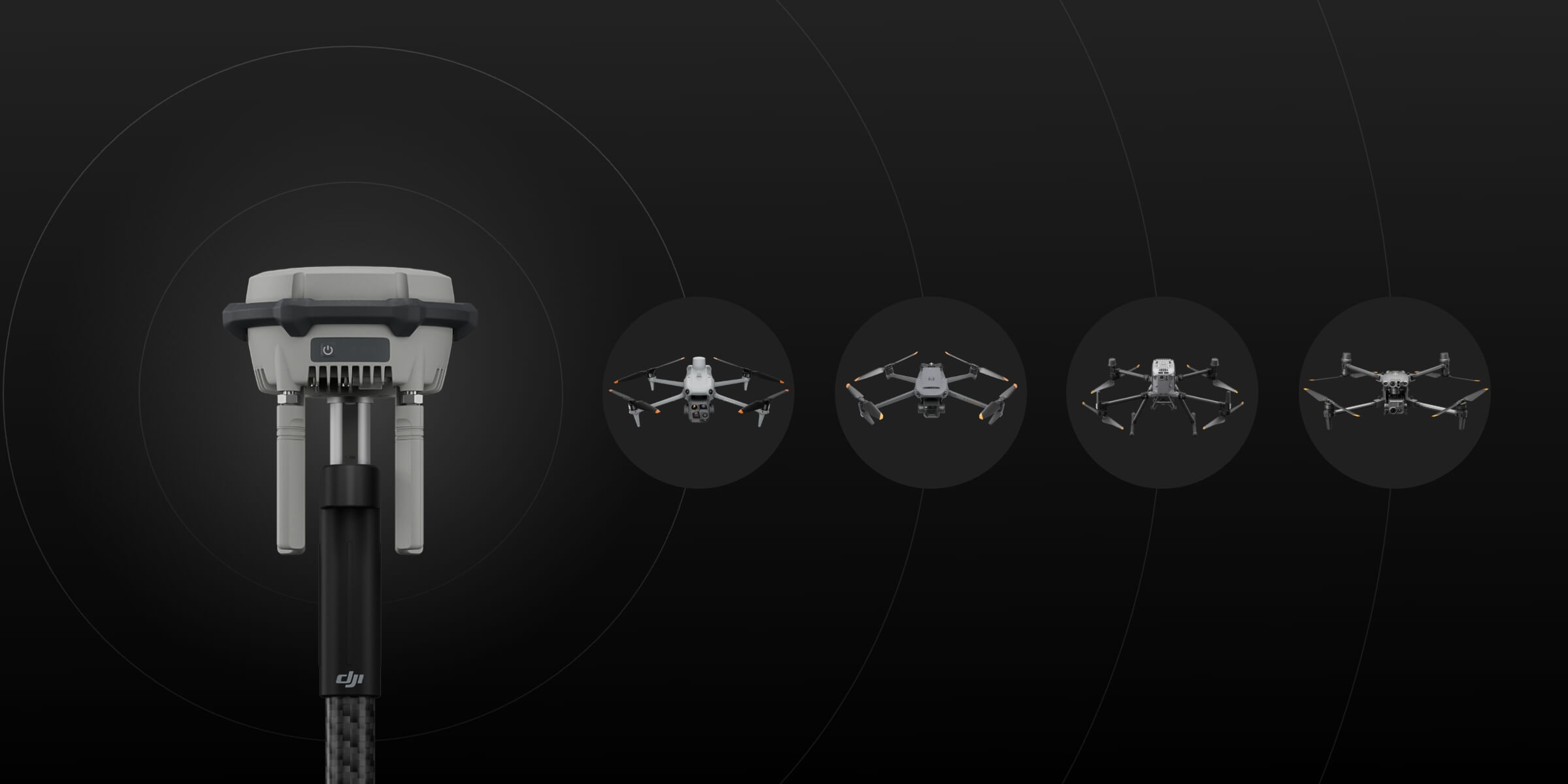
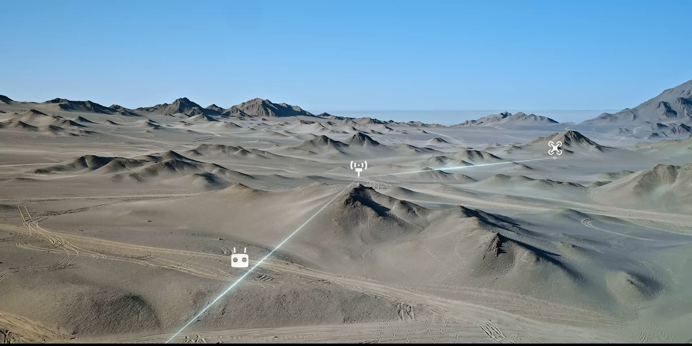
Base station: supports simultaneous operation of several modelsD-RTK 3 supports the new O4 ENT image transmission with four external directional antennas, enabling image transmission up to 15 km in base station transmission mode, while ensuring stable signals in all directions. Operators only need to configure a D-RTK 3 multifunction station without additional configuration, allowing multiple drones to be connected to the base station and access to centimetre-level positioning.
Station mode FOR retransmission: exceeding limitsIt is possible to bring the D-RTK 3 into relay station mode and set it in an elevated position in areas with considerable signal obstructions, such as urban environments or valleys. This improves the image transmission distance and extends the operating range of the Matrix 4 series up to 25 kilometres. D-RTK 3 supports obstacle detection with the Matrix 4 series, allowing real-time calculation of obstacles and signal quality between the relay station, radio control and drone. Operators can adjust the drone's position according to the radio control's messages to ensure optimal communication quality.
|
Rover Station mode: flexible and efficient |
In addition to serving as a base station, D-RTK 3 can also be used as a Rover Station to collect the coordinates of control points, increasing the accuracy of APR aerial surveys.
DJI Integrated Mapping Solution
With the new DJI Enterprise app, the D-RTK3 supports ground control point (GCP) setting and tilt compensation
Install the new DJI Enterprise app on an Android device to measure ground control point coordinates without third-party tools. When used with DJI drones that support RTK, the DJI solution can efficiently complete an entire high-precision surveying workflow.
The D-RTK 3 has a built-in high-precision inertial measurement unit, which allows the control point to be measured when the rod is held at an angle without a tripod or by ensuring that the base station is vertical, significantly improving operational efficiency in complex measuring environments.
One-click import, time-saving and simple
Rover measurement results can be exported as control point files via the DJI Enterprise app and imported into DJI Terra without the need for further format adjustments. Powerful algorithms make it easy to generate high-precision results.