
")


Descrizione accessori


Vegetation mapping water body analysis species identification

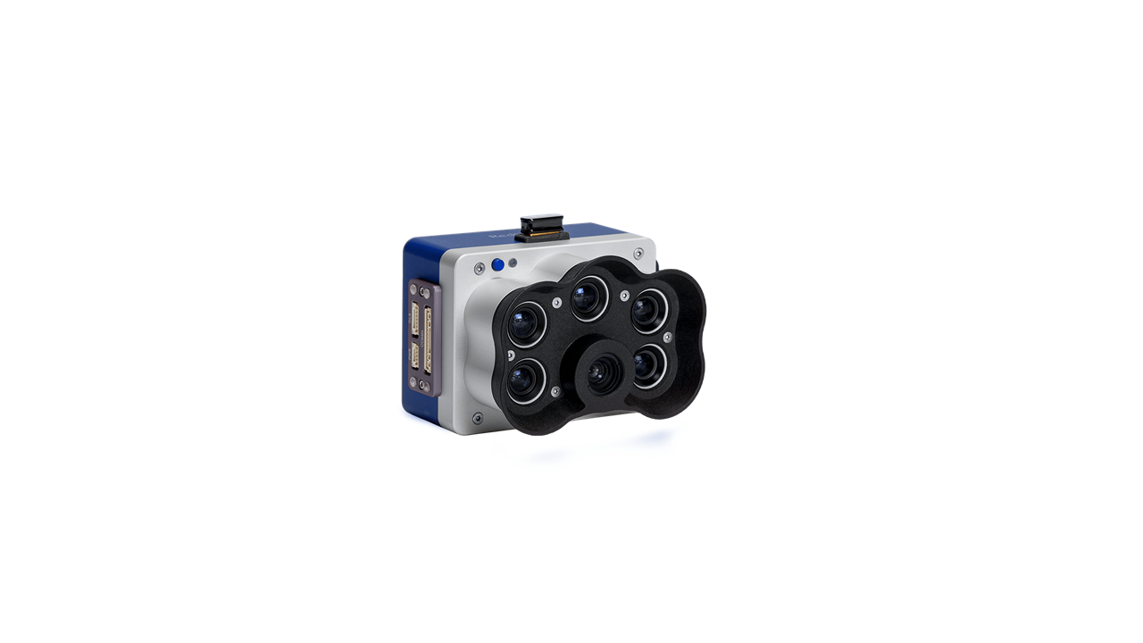
With a high-resolution panchromatic imager, RedEdge-Pblue enables higher resolution RGB and multispectral output: resolution of 2 cm per pixel / 0.78 inches per pixel when flying at 60 m / 200 feet. With sharper images, you can spot issues earlier and make more reliable management decisions in a variety of use cases.
KEY FEATURES |
SYNCHRONIZED SHOOTING BETWEEN HIGH-RESOLUTION RGB IMAGES AND MULTISPECTRAL DATA |
|
Micasense RedEdge-Pblue allows simultaneous capture of up to six bands, enabling multiple high-resolution outputs such as RGB, crop vigor indices and composites (NDVI, NDRE, CIR) and high-resolution panchromatic.
|
ULTRA HIGH RESOLUTION, UNLIMITED ANALYTICAL CAPABILITIESCOASTAL BLUE BAND |
|
The Operational Land Imager Band 1 or coastal blue (0.433-0.453 μm) is useful for imaging shallow water and for tracking fine atmospheric particles such as dust and smoke. Band 1 reflects blue and purple, where light is diffused by dust, smoke and water particles in the air. Collecting data with sufficient sensitivity to this spectrum is difficult. Because water absorbs and scatters light, oceans and lakes tend to appear dark or lacking in detail in satellite imagery.
|
VEGETATION ANALYSIS OF WATER BODIES |
|
Surveys over water for chlorophyll efficiency examination, vegetation analysis and identification of algae or floating, submerged and emergent plants. |
|
The MicaSense Altum-PT captures synchronized multispectral, thermal, and panchromatic data for pixel-aligned outputs at incredibly high resolutions. The capture of these bands happens simultaneously, eliminating the need for data alignment in post-processing.
|
HABITAT MONITORING, PROTECTION AND RESTORATIONErosion and biodiversity inspections, coral reef inspections on shallow waters, inaccessible to ships and sensitive to human interaction.
|
IDENTIFICATION OF PLANT SPECIES AND WEEDSVegetation health management and species identification, including the ability to differentiate and count plants, trees, invasive species, and weeds. |


