
")


MAVIC 3M LEARN MORE, WORK SMARTER
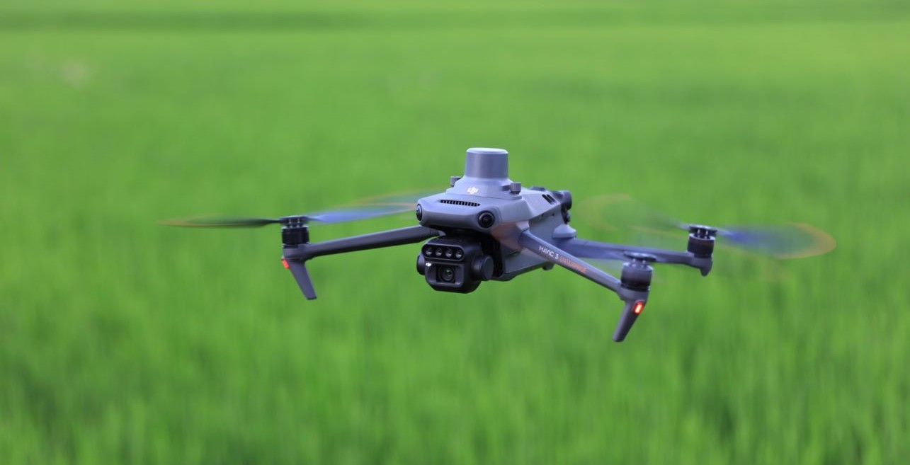
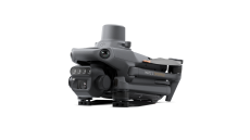
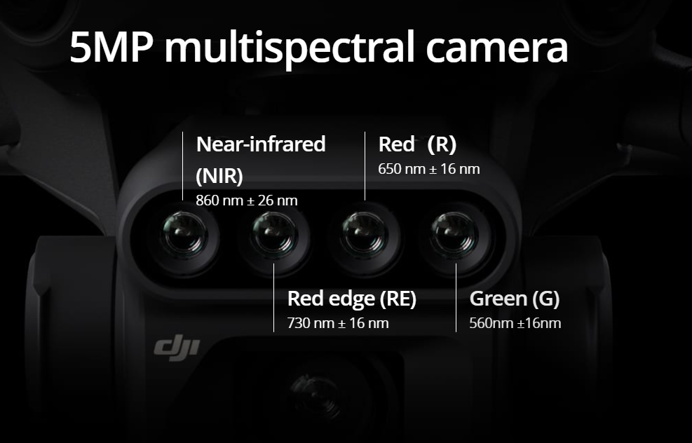
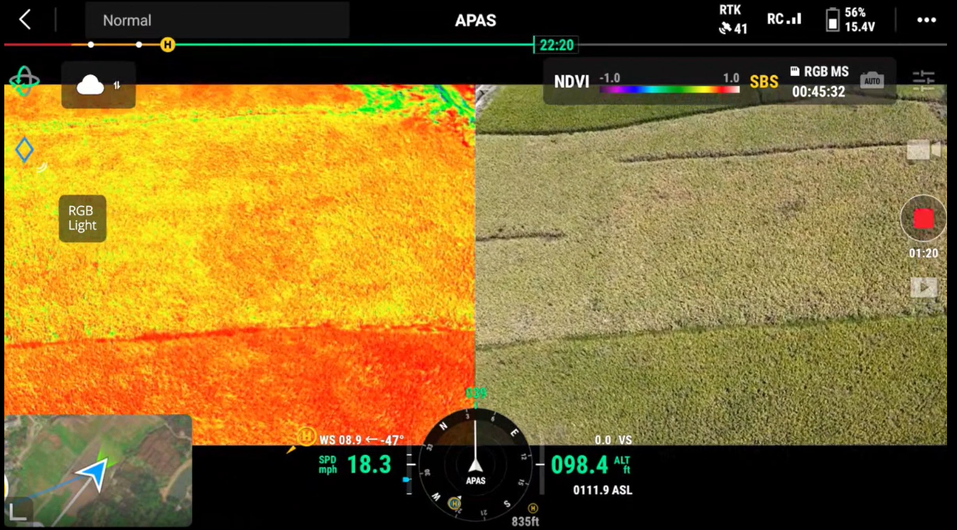
To perform efficient aerial surveys, it is necessary to see the invisible. That's why the Mavic 3 Multispectral has two ways of seeing. It combines an RGB camera with a multispectral camera to scan and analyze crop growth with maximum clarity. Managing agricultural production requires precision and data, and the Mavic 3M offers both. Multispectral cameraThe DJI Mavic 3M is equipped with a 4 × 5 MP multispectral camera that captures images in four spectral bands: green, red, Red Edge and near infrared. These bands provide detailed information about the composition and status of an object or area.
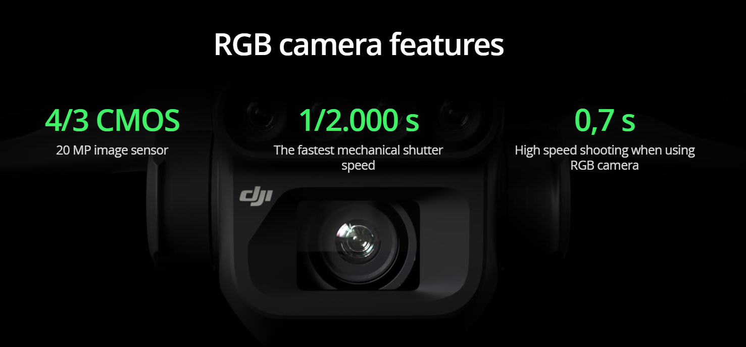
RGB CameraThe DJI Mavic 3M is also equipped with a 20MP RGB camera that captures high-resolution images. This camera can be used to create panoramic images or to perform image analysis.
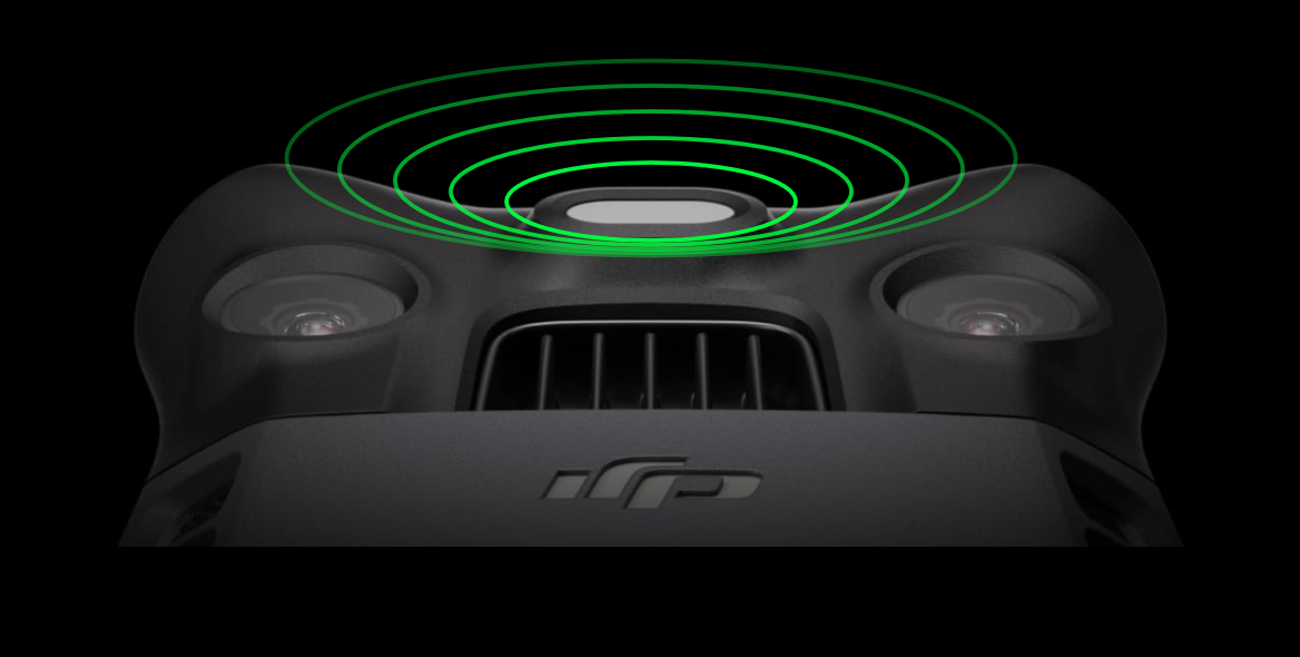
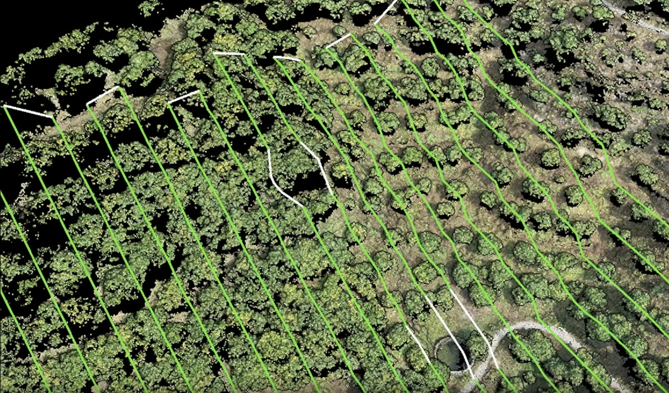
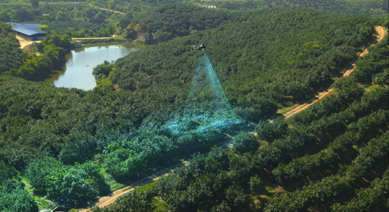
Stability and securityThe DJI Mavic 3M is equipped with an omnidirectional coupling system that allows you to avoid obstacles and fly safely even in strong wind conditions. The transmission distance of 15 km allows you to cover large areas with just one flight. Precise positioningThe DJI Mavic 3M is equipped with a millimeter RTK positioning system that guarantees an accuracy of a few centimeters. Time synchronization in microseconds allows you to obtain perfectly overlapping images. Efficient aerial surveysThe DJI Mavic 3 M is capable of capturing up to 2 square kilometers of images per flight, allowing you to perform aerial surveys quickly. SUNLIGHT SENSOR The built-in sunlight sensor captures solar irradiance and records it in an image file, allowing light compensation of image data during 2D reconstruction. This results in more accurate NDVI results, as well as greater precision and consistency of data captured over time.
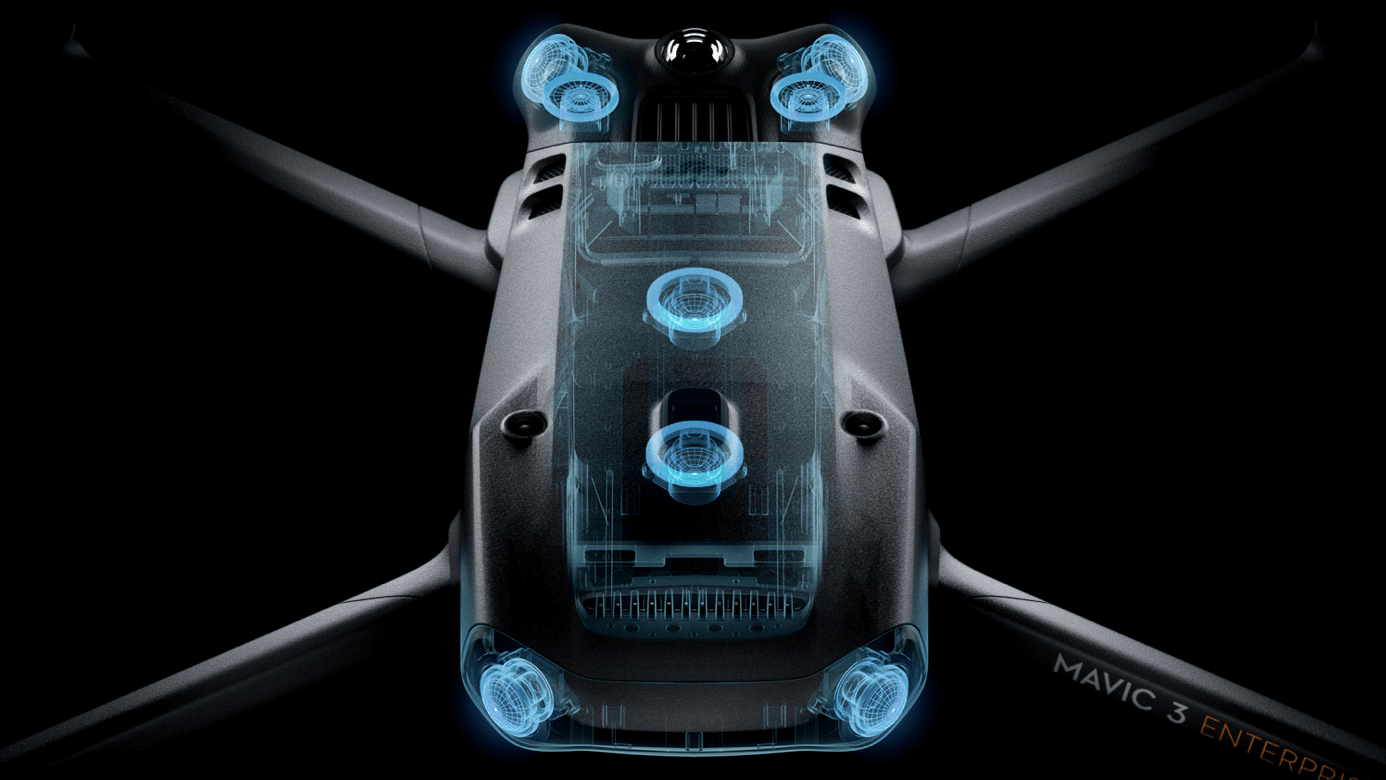
OMNIDIRECTIONAL OBSTACLE DETECTION, AERIAL DETECTION AND TERRAIN TRACKINGThe aircraft is equipped with several wide FOV vision sensors that accurately detect obstacles in all directions to avoid omnidirectional obstacles. Terrain follow aerial surveys can be carried out easily in steep terrain. |
||||||
|
||||||
A NEW SUITE OF TOOLS FOR PROFESSIONALS |
||||||
|
The Mavic 3 series includes new tools that combine accessories and software for professional missions. DJI RC Pro Enterprise is a professional remote controller (RC) with a 1,000-nit high-brightness screen for clear visibility in direct sunlight and a built-in microphone for clear communication. The RTK Module enables survey professionals to achieve pinpoint accuracy with support for network RTKs, custom network RTK services, and the D-RTK 2 mobile station. The D-RTK 2 Mobile Station is DJI's redesigned high-precision GNSS receiver to support all major global satellite navigation systems, offering real-time differential corrections.
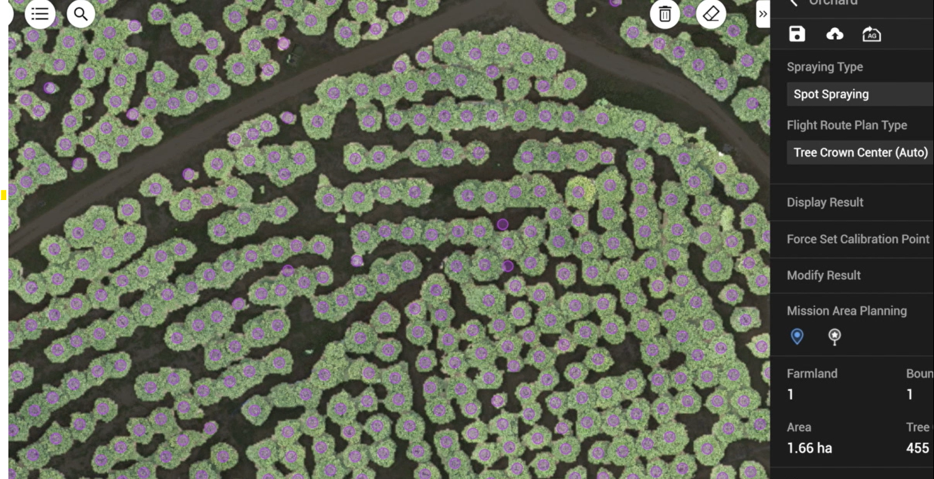
COMPLETE SOFTWARE SUITEThe Mavic 3 Enterprise series drones are at the heart of an advanced and growing software ecosystem for drone operations, enabling aerial platforms to reach their full potential as tools for data collection, mapping, fleet management and flight operations. DJI Pilot 2 is the revamped flight interface, designed to improve pilot efficiency and flight safety. Drone and cargo controls are easily accessible with a single touch. Users can access drone hardware, live streaming video, and photo data. DJI FlightHub 2, the all-in-one cloud operations management software for drone fleets, enables operators to efficiently manage flight operations with route planning and mission management. DJI Terra is a complete mapping software for all stages of work, from mission planning to 2D and 3D model processing. |
||||||
|
APPLICATION USES
|