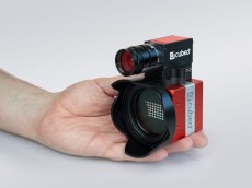
ULTRIS X20 PLUS Dual-Sensor Camera for Drone Applications
The X20 is extended with a second camera sensor: panchromatic – just one band, high resolution. We use this data to increase the spatial resolution of the spectral camera to 1880 x 1880 pixel, giving incredibly detailed images. The extra data allows us to use pansharpening to enhance the images even further and increase the spatial resolution of the spectral data. When it comes to stitching the single data files after the UAV flight, the additional data increases the spatial accuracy of the generated mosaic.
UAV compatible
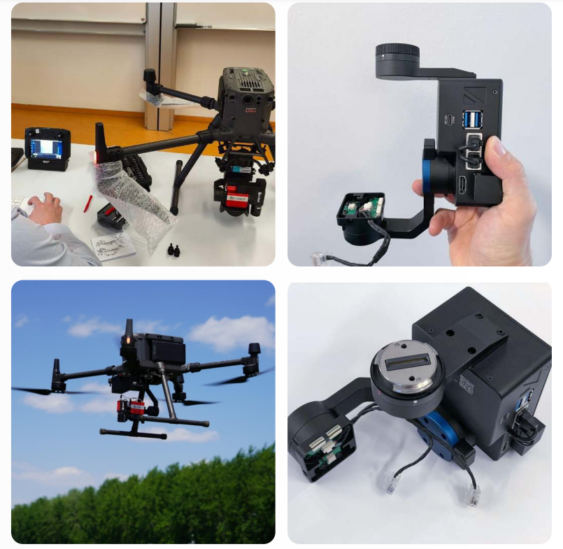
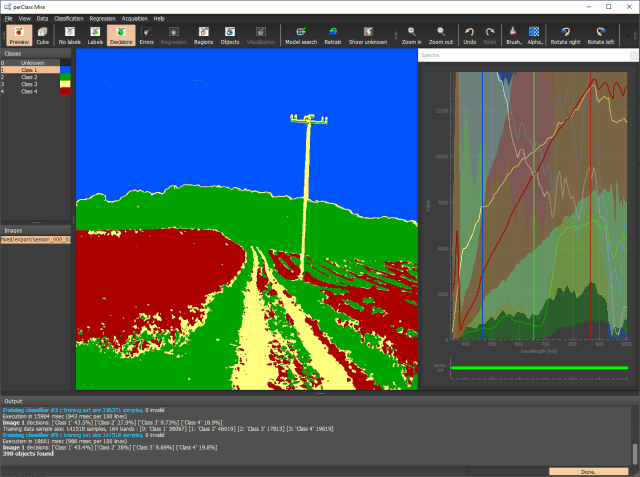
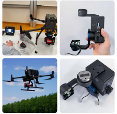
The ULTRIS X20 Plus is compatible with any drone. For recording data the camera can work in time lapse mode or be triggered directly from the UAV. The image on the left shows the camera onboard a DJI Matrice M300 RTK. It is mounted on a gimbal containing a Windows-based mini computer which runs the Cubert CUVIS software and records the data. The gimbal is connected via DJI-Skyport to the UAV, which triggers the camera automatically during the flight and provides the RTK GPS signal for each single data file.
Comprehensive options
The powerful Cubert Utils software takes raw data, reflectance and even radiance and allows hyperspectral videos at up to 8Hz. It allows first analyses on recorded image cubes, as well as directly on the live data stream. Spectral indices such as Hyperspectral NDVI or Chlorophyll Absorption Integral (CAI), customized plug-ins, and even classification solutions can be directly applied in real-time. The dedicated server allows for autonomous operation during drone flights. While retaining a minimal raw data consumption, the exported data, available in ENVI, Tiff or Multitiff, seamlessly integrates with common GIS and mapping software, including pan-sharpening.
Application field
AERIAL MAPPING
X20 Plus was designed for aerial mapping, gathering high resolution hyperspectral images. Even though the X20 plus integrates two camera sensors it is still lightweight (less than 690 g), so together with a mini computer and GPS the payload is less than 1.5 kg, making it suitable for a wide range of drones.
SCIENTIFIC RESEARCH
X20 Plus can, of course, also be used on the ground, whether in the field or in the lab. The non-scanning snapshot allows you to capture the complete data cube within a few milliseconds. The X20 Plus is the right choice for anyone who needs both high resolution and ease-of-use.
Specifiche Tecniche
Specifiche tecniche ULTRIS X20 Plus
FOV (campo visivo) 35°
Profondità dati 12 bit
Frequenza fotogrammi massima 4 Hz
Collegamento dati GigE
Sensore CMOSIS CMV20000
Sensore Pan Sony IMX264
Dimensioni del file non elaborate < 25 MB (< panoramica di 2,5 MB)
Dimensioni del file elaborate < 55 MB (< 1,2 GB
pansharpened)
Peso 630 g
Dimensioni 86 x 121 x105 mm
Campo luminoso tecnologico
Readout Otturatore globale
Risoluzione spaziale 410 x 410 pixel
Risoluzione spaziale Panoramica 1886 x 1886 pixel
Gamma di lunghezze d'onda 350 – 1000 nm
Bande spettrali 164
Campionamento spettrale 4 nm
FWHM costante 10 nm
Mosaico del filtro passa banda
Tempo di integrazione 0,1 – 1000 ms

")


